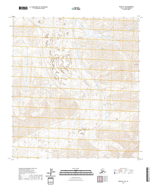
2023 Map of Denali B-1 SW
USGS Topo · Published 2023About this map
Denali National Park and the expansive Denali Wilderness dominate this high-altitude Alaskan landscape, where the northern reaches of the Alaska Range rise into sharp peaks and ridges. The terrain is defined by its dramatic verticality, as glacial drainage systems like Glacier Creek and its tributaries carve deep through the valley floors. Several prominent geological landmarks serve as natural navigational points, including the towering Castle Rock in the northeast and the centrally located Green Point. The hydrography here is characterized by steep, fast-flowing mountain streams such as Crystal Creek, Wolverine Creek, and the isolated Pirate Creek, which together illustrate the complex watershed of this protected subarctic ecosystem. While devoid of permanent settlements or roads, the map details the intricate contour patterns and summits like Red Mtn that define the character of this interior Alaskan wilderness.
Find a feature on this map
14 named features on this map. Tap any name to fly to it.
Don’t see what you’re looking for? This feature index may not catch every label — zoom into the map to look around manually.
Map Details
Editions of this 2023 Denali B-1 SW Map
This is the sole edition of this map. No revisions or reprints were ever made.
Other maps of this area

1952 · Mount McKinley
USGS Topo · 1:250,000

1952 · Mount McKinley B-2
USGS Topo · 1:63,360

1952 · Mount McKinley B-1
USGS Topo · 1:63,360

1954 · Mount McKinley B-1
USGS Topo · 1:63,360

1954 · Mount McKinley A-2
USGS Topo · 1:63,360

1954 · Mount McKinley A-1
USGS Topo · 1:63,360

1954 · Mount McKinley B-2
USGS Topo · 1:63,360

1958 · Mount McKinley
USGS Topo · 1:250,000

1969 · Mount McKinley
USGS Topo · 1:250,000
2015 · Denali B-1 NE
USGS Topo · 1:25,000