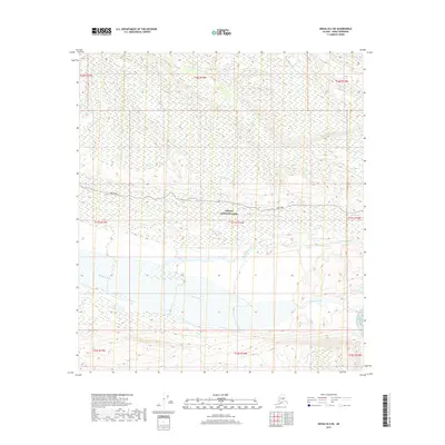
2019 Map of Denali B-2 NE
USGS Topo · Published 2019About this map
Denali National Park encompasses the vast majority of this 2019 survey, defined by its braided glacial river systems and high-altitude terrain. The McKinley River dominates the southern half of the sheet, carving a wide alluvial path through the landscape, while the Thorofare River and Moose Cr flow through the central and northern sections. Human infrastructure is minimal, represented primarily by the winding corridor of the Park Road, which provides the only significant terrestrial access through the center of the park boundaries. The map illustrates the complex hydrography of the interior, where shifting river channels and seasonal wetlands create an ever-evolving natural environment within the protected park lands.
Find a feature on this map
14 named features on this map. Tap any name to fly to it.
Don’t see what you’re looking for? This feature index may not catch every label — zoom into the map to look around manually.
Map Details
Editions of this 2019 Denali B-2 NE Map
This is the sole edition of this map. No revisions or reprints were ever made.
Other maps of this area

1952 · Mount McKinley
USGS Topo · 1:250,000

1952 · Mount McKinley B-2
USGS Topo · 1:63,360

1952 · Mount McKinley B-1
USGS Topo · 1:63,360

1952 · Mount McKinley C-1
USGS Topo · 1:63,360

1952 · Mount McKinley C-2
USGS Topo · 1:63,360

1954 · Mount McKinley C-1
USGS Topo · 1:63,360

1954 · Mount McKinley B-1
USGS Topo · 1:63,360

1954 · Mount McKinley B-2
USGS Topo · 1:63,360

1954 · Mount McKinley C-2
USGS Topo · 1:63,360

1958 · Mount McKinley
USGS Topo · 1:250,000