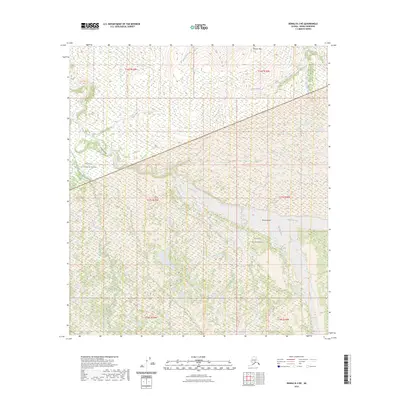
2023 Map of Denali B-3 NE
USGS Topo · Published 2023About this map
Denali National Park and the Denali Wilderness define this interior Alaskan landscape, where the braided channels of the McKinley River and Muddy River converge. This 2023 survey documents the intricate hydrologic patterns of the region, featuring the broad gravel deposits of McKinley Bar and the steep passage of Eagle Gorge. The terrain rises toward the northern boundary at Brooker Mtn, with numerous drainages like Slate Creek and Eldorado Creek cutting through the high country. The lack of established roads or permanent settlements reflects the protected status of these lands, emphasizing a wilderness character preserved for conservation and research. The map provides a detailed view of the natural topography and water systems as they exist in the early twenty-first century.
Find a feature on this map
16 named features on this map. Tap any name to fly to it.
Don’t see what you’re looking for? This feature index may not catch every label — zoom into the map to look around manually.
Map Details
Editions of this 2023 Denali B-3 NE Map
This is the sole edition of this map. No revisions or reprints were ever made.
Other maps of this area

1952 · Mount McKinley
USGS Topo · 1:250,000

1952 · Mount McKinley B-2
USGS Topo · 1:63,360

1952 · Mount McKinley C-3
USGS Topo · 1:63,360

1952 · Mount McKinley C-2
USGS Topo · 1:63,360

1953 · Mount McKinley B-3
USGS Topo · 1:63,360

1954 · Mount McKinley B-3
USGS Topo · 1:63,360

1954 · Mount McKinley B-2
USGS Topo · 1:63,360

1954 · Mount McKinley C-2
USGS Topo · 1:63,360

1958 · Mount McKinley
USGS Topo · 1:250,000

1969 · Mount McKinley
USGS Topo · 1:250,000