
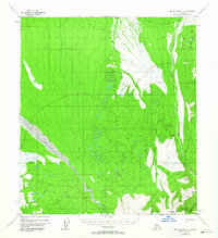
1952 Map of Mount McKinley C-3
USGS Topo · Published 1957About this map
Brooker Mtn and the steep elevations of the Kantishna Hills dominate the southeastern corner of this subarctic landscape, where high ridges like Alpha Ridge overlook a complex network of glacial drainage. The glacial braids of the McKinley River sweep across the western half of the territory, defining a broad valley of gravel and silt. This mid-century survey captures the region before extensive modern development, documenting a remote interior where transportation was limited to a rudimentary Trail and a seasonal Sled Road cutting through the northern marshes. To the east, Moose Creek flows through the Lower Canyon, joined by smaller tributaries like Eldorado Creek and Reinhart Creek that descend from the high ground near Reindeer Hill. The map reveals a wilderness shaped by extreme topography and water, showing the natural corridors used for early movement through the territory.
Find a feature on this map
12 named features on this map. Tap any name to fly to it.
Don’t see what you’re looking for? This feature index may not catch every label — zoom into the map to look around manually.
Map Details
Editions of this 1952 Mount McKinley C-3 Map
2 editions found
Other maps of this area

1952 · Mount McKinley
USGS Topo · 1:250,000

1952 · Mount McKinley B-2
USGS Topo · 1:63,360

1952 · Mount McKinley C-2
USGS Topo · 1:63,360

1952 · Mount McKinley D-3
USGS Topo · 1:63,360

1953 · Mount McKinley B-4
USGS Topo · 1:63,360

1953 · Mount McKinley B-3
USGS Topo · 1:63,360

1953 · Mount McKinley C-4
USGS Topo · 1:63,360

1953 · Mount McKinley D-4
USGS Topo · 1:63,360

1954 · Mount McKinley C-4
USGS Topo · 1:63,360

1954 · Mount McKinley D-4
USGS Topo · 1:63,360