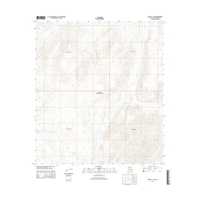
2015 Map of Denali C-1 SW
USGS Topo · Published 2015About this map
Denali National Park encompasses the high-altitude terrain of this interior Alaskan landscape, where drainage patterns define the geography. Glacial melt and seasonal runoff feed major waterways like the Clearwater Fork in the west and the meandering Stony Cr in the east. The map captures a transition of hydrographic features, including the headwaters of Boundary Cr and the upper reaches of N Fork Moose Cr in the southern sections. This 2015 survey illustrates the preserved wild character of the region, emphasizing the natural topography within the Public Land Survey System grids of t15s r15w, t15s r14w, t16s r15w, and t16s r14w. The lack of human infrastructure or roads underscores the status of this area as a protected wilderness managed for conservation and research.
Find a feature on this map
9 named features on this map. Tap any name to fly to it.
Don’t see what you’re looking for? This feature index may not catch every label — zoom into the map to look around manually.
Map Details
Editions of this 2015 Denali C-1 SW Map
This is the sole edition of this map. No revisions or reprints were ever made.
Other maps of this area

1952 · Mount McKinley
USGS Topo · 1:250,000

1952 · Mount McKinley B-2
USGS Topo · 1:63,360

1952 · Mount McKinley B-1
USGS Topo · 1:63,360

1952 · Mount McKinley C-1
USGS Topo · 1:63,360

1952 · Mount McKinley C-2
USGS Topo · 1:63,360

1954 · Mount McKinley C-1
USGS Topo · 1:63,360

1954 · Mount McKinley B-1
USGS Topo · 1:63,360

1954 · Mount McKinley B-2
USGS Topo · 1:63,360

1954 · Mount McKinley C-2
USGS Topo · 1:63,360

1958 · Mount McKinley
USGS Topo · 1:250,000