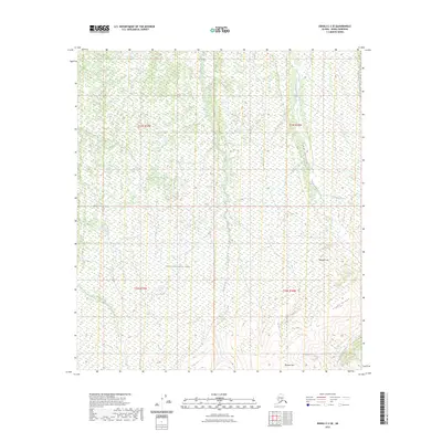
2023 Map of Denali C-3 SE
USGS Topo · Published 2023About this map
Denali National Park encompasses this high-altitude landscape, characterized by significant elevation changes and a complex drainage system. The topography is defined by prominent peaks and ridges, including the southeast-to-northwest span of Alpha Ridge and the distinct summit of Brooker Mtn near the southern boundary. These landforms dictate the flow of several waterways, most notably Moose Creek, which carves through the Lower Canyon as it moves north. To the east, Reindeer Hill stands as a focal point among the tributaries of Canyon Creek. The drainage patterns here, featuring Bear Creek, Reinhart Creek, and Eldorado Creek, illustrate a classic subarctic alpine environment where water and ice have shaped the terrain over millennia. This modern survey provides a clear view of the wilderness character and natural boundaries within the park's interior.
Find a feature on this map
14 named features on this map. Tap any name to fly to it.
Don’t see what you’re looking for? This feature index may not catch every label — zoom into the map to look around manually.
Map Details
Editions of this 2023 Denali C-3 SE Map
This is the sole edition of this map. No revisions or reprints were ever made.
Other maps of this area

1952 · Mount McKinley
USGS Topo · 1:250,000

1952 · Mount McKinley B-2
USGS Topo · 1:63,360

1952 · Mount McKinley C-3
USGS Topo · 1:63,360

1952 · Mount McKinley C-2
USGS Topo · 1:63,360

1953 · Mount McKinley B-3
USGS Topo · 1:63,360

1954 · Mount McKinley B-3
USGS Topo · 1:63,360

1954 · Mount McKinley B-2
USGS Topo · 1:63,360

1954 · Mount McKinley C-2
USGS Topo · 1:63,360

1958 · Mount McKinley
USGS Topo · 1:250,000

1969 · Mount McKinley
USGS Topo · 1:250,000