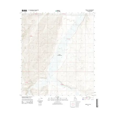
2015 Map of Denali D-1 NE
USGS Topo · Published 2015About this map
Denali National Park encompasses this entire subarctic terrain, defined by the extensive braided system of the Toklat River. This 2015 survey illustrates a landscape dominated by river hydrology and mountain drainage, where the main river channel is joined by the East Fork Toklat River and Wigand Cr. The mapping of these drainages, alongside smaller tributaries like Alder Cr and Little Bear Cr, provides a detailed record of the shifting gravel bars and watercourses that characterize the northern reaches of the park.
Find a feature on this map
12 named features on this map. Tap any name to fly to it.
Don’t see what you’re looking for? This feature index may not catch every label — zoom into the map to look around manually.
Map Details
Editions of this 2015 Denali D-1 NE Map
This is the sole edition of this map. No revisions or reprints were ever made.
Other maps of this area

1948 · Kantishna River
USGS Topo · 1:250,000

1950 · Fairbanks
USGS Topo · 1:250,000

1951 · Healy
USGS Topo · 1:250,000

1951 · Kantishna River
USGS Topo · 1:250,000

1951 · Fairbanks
USGS Topo · 1:250,000

1951 · Mount McKinley D-1
USGS Topo · 1:63,360

1951 · Healy D-6
USGS Topo · 1:63,360

1952 · Mount McKinley
USGS Topo · 1:250,000

1952 · Fairbanks A-6
USGS Topo · 1:63,360

1952 · Kantishna River A-1
USGS Topo · 1:63,360