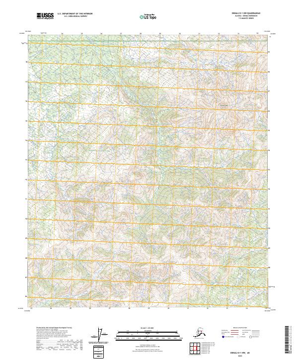
2023 Map of Denali D-1 NW
USGS Topo · Published 2023About this map
Denali National Park encompasses the vast majority of this landscape, where the interior Alaskan wilderness is defined by high-elevation drainage systems and prominent summits. The northern slopes of Chitsia Mtn dominate the northeastern terrain, serving as the headwaters for several branching watercourses. Chitsia Creek flows through the central portion of the quadrangle, while Flume Creek and the headwaters of Little Bear Creek carve through the southern sections. This 2023 survey by the U.S. Geological Survey utilizes data from the National Hydrography Dataset and National Elevation Dataset to document the precise hydrology of this protected area. The map illustrates a region devoid of developed roads or settlements, emphasizing the natural state of the park's interior and the complex network of minor tributaries like Alder Creek that feed into larger Alaskan river systems.
Find a feature on this map
11 named features on this map. Tap any name to fly to it.
Don’t see what you’re looking for? This feature index may not catch every label — zoom into the map to look around manually.
Map Details
Editions of this 2023 Denali D-1 NW Map
This is the sole edition of this map. No revisions or reprints were ever made.
Other maps of this area

1948 · Kantishna River
USGS Topo · 1:250,000

1951 · Kantishna River
USGS Topo · 1:250,000

1951 · Mount McKinley D-1
USGS Topo · 1:63,360

1952 · Mount McKinley
USGS Topo · 1:250,000

1952 · Kantishna River A-1
USGS Topo · 1:63,360

1952 · Kantishna River
USGS Topo · 1:250,000

1952 · Kantishna River A-2
USGS Topo · 1:63,360
1953 · Kantishna River A-1
USGS Topo · 1:63,360

1954 · Mount McKinley D-2
USGS Topo · 1:63,360

1954 · Mount McKinley D-1
USGS Topo · 1:63,360