
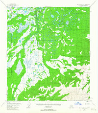
1954 Map of Mount McKinley D-2
USGS Topo · Published 1958About this map
The Kantishna Hills dominate the southeastern portion of this mid-century survey, where the elevation rises sharply from the marshy lowlands of the north. The small settlement of Diamond sits at the edge of the wetlands, positioned near the VABM Diamond survey marker. This area represents a remote subarctic landscape where transport relied on specialized infrastructure, evidenced by the Sled Road cutting across the northwest and the Crooked Creek Airstrip tucked into the higher ground to the south. The drainage network is defined by the meandering Bearpaw River and numerous tributaries such as Bear Creek, Flume Creek, and Moose Creek. These watercourses create a complex pattern of muskeg and small lakes that characterize the interior Alaskan terrain before more modern road networks were established.
Find a feature on this map
11 named features on this map. Tap any name to fly to it.
Don’t see what you’re looking for? This feature index may not catch every label — zoom into the map to look around manually.
Map Details
Editions of this 1954 Mount McKinley D-2 Map
2 editions found
Other maps of this area

1948 · Kantishna River
USGS Topo · 1:250,000

1951 · Kantishna River
USGS Topo · 1:250,000

1951 · Mount McKinley D-1
USGS Topo · 1:63,360

1952 · Mount McKinley
USGS Topo · 1:250,000

1952 · Kantishna River A-3
USGS Topo · 1:63,360

1952 · Kantishna River A-1
USGS Topo · 1:63,360

1952 · Kantishna River
USGS Topo · 1:250,000

1952 · Mount McKinley C-3
USGS Topo · 1:63,360

1952 · Kantishna River A-2
USGS Topo · 1:63,360

1952 · Mount McKinley C-1
USGS Topo · 1:63,360