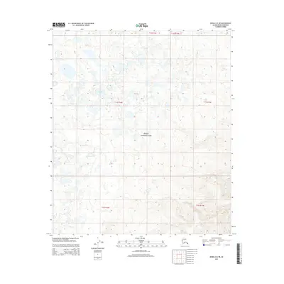
2015 Map of Denali D-2 NE
USGS Topo · Published 2015About this map
Denali National Park encompasses the vast majority of this landscape, which is defined by a dense network of alpine drainage systems and small water bodies. The terrain is dominated by the wandering path of Flume Cr, which cuts through the central and western portions of the quadrangle. Tucked into the north-central area is Sandless Lake, one of the few named landmarks in this stretch of the interior. The map reflects a 2015 survey of the public land survey system, showing the township and range boundaries including t11s r16w and t11s r15w. This record captures the untouched character of the borough's interior prior to any modern development or road expansion, serving as a baseline for the natural hydrology and topographical contours of the region.
Find a feature on this map
9 named features on this map. Tap any name to fly to it.
Don’t see what you’re looking for? This feature index may not catch every label — zoom into the map to look around manually.
Map Details
Editions of this 2015 Denali D-2 NE Map
This is the sole edition of this map. No revisions or reprints were ever made.
Other maps of this area

1948 · Kantishna River
USGS Topo · 1:250,000

1951 · Kantishna River
USGS Topo · 1:250,000

1951 · Mount McKinley D-1
USGS Topo · 1:63,360

1952 · Mount McKinley
USGS Topo · 1:250,000

1952 · Kantishna River A-1
USGS Topo · 1:63,360

1952 · Kantishna River
USGS Topo · 1:250,000

1952 · Kantishna River A-2
USGS Topo · 1:63,360
1953 · Kantishna River A-1
USGS Topo · 1:63,360

1954 · Mount McKinley D-2
USGS Topo · 1:63,360

1954 · Mount McKinley D-1
USGS Topo · 1:63,360