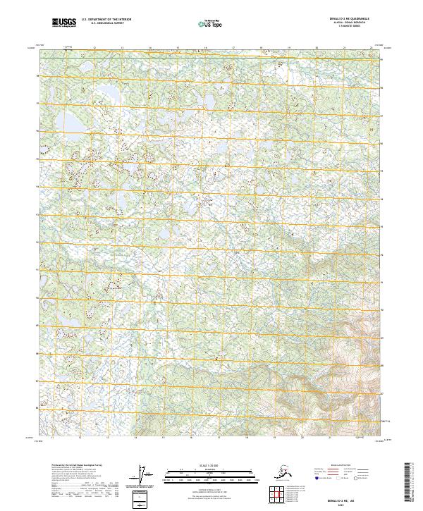
2023 Map of Denali D-2 NE
USGS Topo · Published 2023About this map
Denali National Park encompasses a significant portion of this interior Alaskan landscape, characterized by a complex network of wetlands and small glacial ponds. The terrain is marked by a subtle but persistent drainage pattern, most notably defined by the path of Flume Creek as it moves through the southern sections. This 2023 survey illustrates the remote wilderness character of the region, where the land is largely defined by natural water systems and topographic contours rather than human infrastructure or established settlements. The Public Land Survey System grid, including designations such as t11s r16w and t12s r15w, provides the primary framework for locating specific points within this vast protected area.
Find a feature on this map
7 named features on this map. Tap any name to fly to it.
Don’t see what you’re looking for? This feature index may not catch every label — zoom into the map to look around manually.
Map Details
Editions of this 2023 Denali D-2 NE Map
This is the sole edition of this map. No revisions or reprints were ever made.
Other maps of this area

1948 · Kantishna River
USGS Topo · 1:250,000

1951 · Kantishna River
USGS Topo · 1:250,000

1951 · Mount McKinley D-1
USGS Topo · 1:63,360

1952 · Mount McKinley
USGS Topo · 1:250,000

1952 · Kantishna River A-1
USGS Topo · 1:63,360

1952 · Kantishna River
USGS Topo · 1:250,000

1952 · Kantishna River A-2
USGS Topo · 1:63,360
1953 · Kantishna River A-1
USGS Topo · 1:63,360

1954 · Mount McKinley D-2
USGS Topo · 1:63,360

1954 · Mount McKinley D-1
USGS Topo · 1:63,360