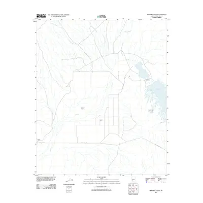
2011 Map of Dendora Valley
USGS Topo · Published 2011About this map
The Gila River winds through this desert landscape in western Maricopa County, entering the narrow passage of Gila River Canyon before spreading into the Painted Rock Reservoir. This 2011 survey captures a region defined by its seasonal hydrology, where numerous named drainages such as Loudermilk Wash, Yellow Medicine Wash, and Woolsey Wash converge toward the river valley. Human presence is concentrated around the Dendora Ranch and the small settlement of Rocky Point. To the east, the Painted Rock Mountains rise sharply from the basin floor. Local transportation is facilitated by several named routes including Poco Dinero Rd and Painted Rock Dam Rd, which provide access to this arid environment of the Dendora Valley.
Find a feature on this map
15 named features on this map. Tap any name to fly to it.
Don’t see what you’re looking for? This feature index may not catch every label — zoom into the map to look around manually.
Map Details
Editions of this 2011 Dendora Valley Map
This is the sole edition of this map. No revisions or reprints were ever made.
Other maps of this area

1942 · Vicksburg
USGS Topo · 1:250,000

1949 · Sentinel
USGS Topo · 1:62,500

1950 · Sentinel
USGS Topo · 1:62,500

1950 · Theba
USGS Topo · 1:62,500

1951 · Theba
USGS Topo · 1:62,500

1951 · Dendora Valley
USGS Topo · 1:62,500

1951 · Woolsey Peak
USGS Topo · 1:62,500

1953 · Ajo
USGS Topo · 1:250,000

1954 · Phoenix
USGS Topo · 1:250,000

1957 · Ajo
USGS Topo · 1:250,000