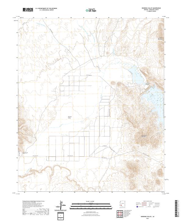
2021 Map of Dendora Valley
USGS Topo · Published 2021About this map
The Dendora Valley landscape is defined by the sharp transition between the arid desert floor and the surrounding peaks of the Gila Bend Mountains and Painted Rock Mountains. Central to the geography is the Gila River, which flows through the Gila River Canyon before entering the Painted Rock Reservoir in the eastern portion of the quadrangle. This area in Maricopa County reflects a network of desert drainages including Loudermilk Wash, Yellow Medicine Wash, and Woolsey Wash, which carve through the valley during seasonal rains. A modest grid of rural roads, such as Poco Dinero Rd and Painted Rock Dam Rd, provides access to the agricultural and recreational lands near the river. The map also identifies local landmarks like Rocky Point, situated near the intersection of several desert tracks.
Find a feature on this map
24 named features on this map. Tap any name to fly to it.
Don’t see what you’re looking for? This feature index may not catch every label — zoom into the map to look around manually.
Map Details
Editions of this 2021 Dendora Valley Map
This is the sole edition of this map. No revisions or reprints were ever made.
Other maps of this area

1942 · Vicksburg
USGS Topo · 1:250,000

1949 · Sentinel
USGS Topo · 1:62,500

1950 · Sentinel
USGS Topo · 1:62,500

1950 · Theba
USGS Topo · 1:62,500

1951 · Theba
USGS Topo · 1:62,500

1951 · Dendora Valley
USGS Topo · 1:62,500

1951 · Woolsey Peak
USGS Topo · 1:62,500

1953 · Ajo
USGS Topo · 1:250,000

1954 · Phoenix
USGS Topo · 1:250,000

1957 · Ajo
USGS Topo · 1:250,000