
1979 Map of Denio
USGS Topo · Published 1979About this map
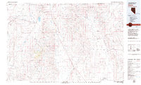
The high desert borderlands between Nevada and Oregon are defined here by a series of parallel mountain ranges and expansive basins during the late 1970s. The Pine Forest Range and Bilk Creek Mountains anchor the central portion of the map, separating the Pueblo Valley from the Kings River Valley. This rugged basin-and-range topography supported a scattered mining economy, evidenced by the Ashdown Mine, Cowden Mine, and Moonlight Mine. The small settlement of Denio serves as the primary hub near the state line, while Denio Junction marks the intersection of the primary route south. To the west, the Sheldon National Wildlife Refuge preserves a significant portion of the volcanic tablelands, including Table Mountain and Big Spring. The presence of numerous intermittent streams like Bilk Creek and ephemeral bodies such as Continental Lake reflects the arid character of this remote corridor.
Find a feature on this map
68 named features on this map. Tap any name to fly to it.
Don’t see what you’re looking for? This feature index may not catch every label — zoom into the map to look around manually.
Map Details
Editions of this 1979 Denio Map
4 editions found

Other maps of this area

1882 · Paradise
USGS Topo · 1:250,000

1886 · Disaster
USGS Topo · 1:250,000

1889 · Long Valley
USGS Topo · 1:250,000

1893 · Paradise
USGS Topo · 1:250,000

1893 · Disaster
USGS Topo · 1:250,000

1954 · Vya
USGS Topo · 1:250,000

1955 · McDermitt
USGS Topo · 1:250,000

1955 · Jordan Valley
USGS Topo · 1:250,000

1955 · Adel
USGS Topo · 1:250,000

1957 · Adel
USGS Topo · 1:250,000