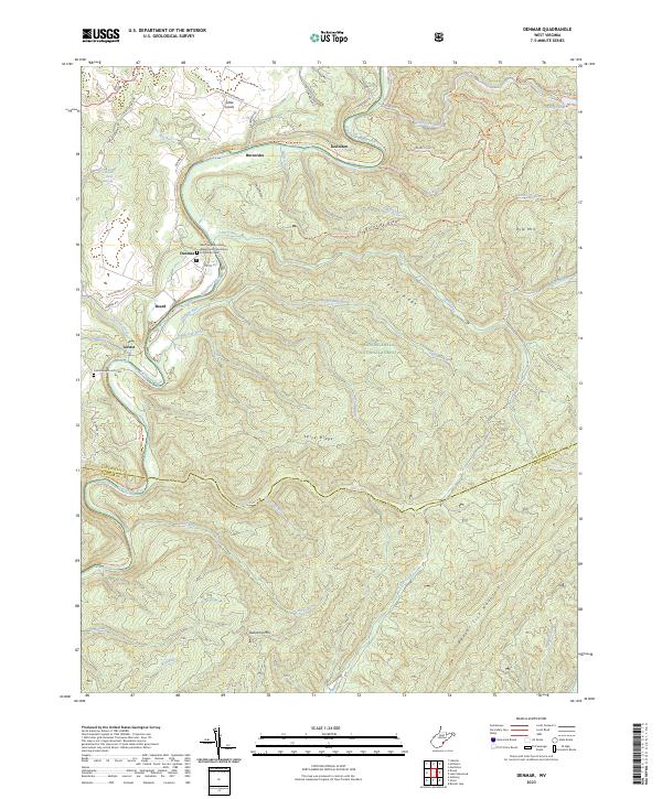
2023 Map of Denmar
USGS Topo · Published 2023About this map
The West Virginia Colored Tuberculosis Sanitarium at Denmar Cem serves as a significant historical anchor on this map, marking a site of critical importance to early 20th-century public health and social history. The settlement of Denmar sits along the Greenbrier River, where the Greenbrier River Rail Trl now follows the legacy path of the railroad through the valley. This landscape is defined by the steep elevation changes between the riverbanks and heights like Beaver Lick Mountain and Pyle Mtn.
Find a feature on this map
63 named features on this map. Tap any name to fly to it.
Don’t see what you’re looking for? This feature index may not catch every label — zoom into the map to look around manually.
Map Details
Editions of this 2023 Denmar Map
This is the sole edition of this map. No revisions or reprints were ever made.
Other maps of this area

1887 · Lewisburg
USGS Topo · 1:125,000

1891 · Lewisburg
USGS Topo · 1:125,000

1891 · Huntersville
USGS Topo · 1:125,000

1894 · Huntersville
USGS Topo · 1:125,000

1921 · Callaghan
USGS Topo · 1:48,000

1921 · White Sulphur Springs
USGS Topo · 1:48,000

1923 · Lobelia
USGS Topo · 1:48,000

1923 · White Sulphur Springs
USGS Topo · 1:62,500

1923 · Marlinton
USGS Topo · 1:48,000

1923 · Callaghan
USGS Topo · 1:62,500