
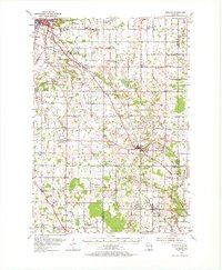
1954 Map of Denmark
USGS Topo · Published 1956About this map
Brown and Manitowoc counties meet in this mid-century survey, where the Chicago and North Western railway cuts a diagonal path toward the expanding outskirts of Green Bay. The landscape is characterized by a dense network of local township schools and country churches that anchored rural life in the 1950s, such as the Spring Creek Sch and Holy Trinity Ch. The map captures a transition in land use, from the agricultural fields surrounding Denmark and Morrison to the industrial and commercial signals near the city, including a Drive-in Theater and several Gravel Pits.
Find a feature on this map
97 named features on this map. Tap any name to fly to it.
Don’t see what you’re looking for? This feature index may not catch every label — zoom into the map to look around manually.
Map Details
Editions of this 1954 Denmark Map
2 editions found
Other maps of this area

1952 · Casco
USGS Topo · 1:62,500

1954 · De Pere
USGS Topo · 1:62,500

1954 · Kewaunee
USGS Topo · 1:62,500

1954 · Manitowoc
USGS Topo · 1:62,500

1954 · Green Bay West
USGS Topo · 1:24,000

1954 · De Pere
USGS Topo · 1:24,000

1954 · New Franken
USGS Topo · 1:62,500

1954 · Green Bay East
USGS Topo · 1:24,000

1954 · Chilton
USGS Topo · 1:62,500

1954 · Reedsville
USGS Topo · 1:62,500