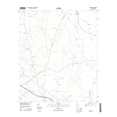
2014 Map of Denmark
USGS Topo · Published 2014About this map
Brooklet and the rural crossroads of Denmark anchor this landscape in Bulloch County, where the Lowcountry terrain is defined by a complex network of slow-moving water and seasonal wetlands. The drainage of Upper Black Cr and Lower Black Cr dictates the local geography, feeding into larger systems like the Luke Swamp and creating numerous agricultural impoundments such as Trapnell Pond and Whitaker Pond. The map reveals a deeply rooted community infrastructure, evidenced by family-named landmarks like Eb Lee Ford and several small cemeteries including Anderson Cem and Piney Grove Cem. In the northwest, the settlement of Emit sits near the headwaters of Zeiterower Br, while the eastern portion of the quadrangle is traversed by a Railroad Bed Rd, reflecting the region's long-standing reliance on rail and road corridors like Us-80 for transporting agricultural goods from sites like Truckers.
Find a feature on this map
92 named features on this map. Tap any name to fly to it.
Don’t see what you’re looking for? This feature index may not catch every label — zoom into the map to look around manually.
Map Details
Editions of this 2014 Denmark Map
This is the sole edition of this map. No revisions or reprints were ever made.
Other maps of this area

1919 · Claxton
USGS Topo · 1:62,500

1920 · Pembroke
USGS Topo · 1:62,500

1920 · Statesboro
USGS Topo · 1:62,500

1921 · Brooklet
USGS Topo · 1:62,500

1943 · Brooklet
USGS Topo · 1:62,500

1943 · Statesboro
USGS Topo · 1:62,500

1944 · Claxton
USGS Topo · 1:62,500

1947 · Savannah
USGS Topo · 1:250,000

1948 · Savannah
USGS Topo · 1:250,000

1948 · Pembroke
USGS Topo · 1:62,500