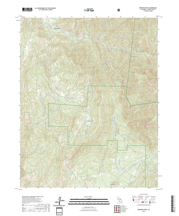
2023 Map of Dennison Peak
USGS Topo · Published 2023About this map
Sequoia National Park and the John Krebs Wilderness dominate the northern landscape of this region, where the South Fork Kaweah River cuts through complex mountain terrain. The map traces the rugged elevation shifts between the high summit of Dennison Peak and the drainage of the North Fork Tule River to the south. Notable for its overlapping conservation boundaries, the area includes the Blue Ridge National Wildlife Refuge and large tracts of the Sequoia National Forest.
Find a feature on this map
41 named features on this map. Tap any name to fly to it.
Don’t see what you’re looking for? This feature index may not catch every label — zoom into the map to look around manually.
Map Details
Editions of this 2023 Dennison Peak Map
This is the sole edition of this map. No revisions or reprints were ever made.
Other maps of this area

1904 · Kaweah
USGS Topo · 1:125,000

1909 · Kaweah
USGS Topo · 1:125,000

1937 · Kaweah
USGS Topo · 1:125,000

1948 · Fresno
USGS Topo · 1:250,000

1955 · Fresno
USGS Topo · 1:250,000

1956 · Fresno
USGS Topo · 1:250,000

1956 · Mineral King
USGS Topo · 1:62,500
1956 · Camp Nelson
USGS Topo · 1:62,500
1957 · Kaweah
USGS Topo · 1:62,500
1957 · Frazier Valley
USGS Topo · 1:24,000