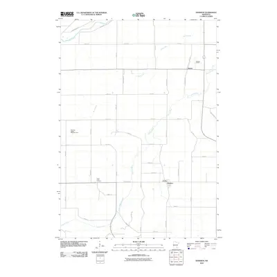
2010 Map of Dennison
USGS Topo · Published 2010About this map
Stanton and Dennison anchor this agricultural landscape in southeastern Minnesota, where the drainage of the Cannon River and Prairie Creek dictates the layout of the land. The topography is defined by the winding course of the creeks and the engineered water management of the Horning-Festler Detention Dam. For local historians and genealogists, the map identifies key community pillars such as the Dennison Post Office and the Prairie Creek Cemetery, providing spatial context for family records and settlement patterns. The presence of the Stanton Airfield in the northeastern corner highlights the area's continued utility as a transportation hub. A network of rural routes, including Cannon River Blvd and Sciota Trl, connects the scattered farmsteads and small towns, illustrating the persistent rural character of Goodhue County into the early 21st century.
Find a feature on this map
42 named features on this map. Tap any name to fly to it.
Don’t see what you’re looking for? This feature index may not catch every label — zoom into the map to look around manually.
Map Details
Editions of this 2010 Dennison Map
This is the sole edition of this map. No revisions or reprints were ever made.
Other maps of this area

1953 · Saint Paul
USGS Topo · 1:250,000

1957 · Farmington
USGS Topo · 1:62,500

1957 · Hastings
USGS Topo · 1:62,500

1959 · Saint Paul
USGS Topo · 1:250,000

1960 · Northfield
USGS Topo · 1:24,000

1960 · Cannon City
USGS Topo · 1:24,000

1960 · Dennison
USGS Topo · 1:24,000

1960 · Nerstrand
USGS Topo · 1:24,000

1968 · Kenyon
USGS Topo · 1:24,000

1968 · Sogn
USGS Topo · 1:24,000