
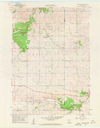
1960 Map of Nerstrand
USGS Topo · Published 1961About this map
Nerstrand Woods State Park anchors the northwestern corner of this landscape, preserving a remnant of the region's native hardwoods amid the expansive agricultural fields of Wheeling and Holden townships. The village of Nerstrand serves as the central hub, situated along the Chicago Great Western railroad line. Further south, the Chicago Milwaukee St Paul and Pacific tracks follow the valley of the North Branch Zumbro River, marking a secondary industrial corridor defined by local Gravel Pits.
Find a feature on this map
28 named features on this map. Tap any name to fly to it.
Don’t see what you’re looking for? This feature index may not catch every label — zoom into the map to look around manually.
Map Details
Editions of this 1960 Nerstrand Map
2 editions found
Other maps of this area

1953 · Saint Paul
USGS Topo · 1:250,000

1959 · Saint Paul
USGS Topo · 1:250,000

1960 · Northfield
USGS Topo · 1:24,000

1960 · Cannon City
USGS Topo · 1:24,000

1960 · Dennison
USGS Topo · 1:24,000

1962 · Medford East
USGS Topo · 1:24,000

1962 · Moland
USGS Topo · 1:24,000

1965 · West Concord
USGS Topo · 1:24,000

1968 · Kenyon
USGS Topo · 1:24,000

1968 · Sogn
USGS Topo · 1:24,000