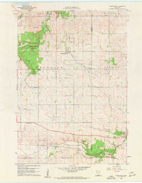
1960 Map of Nerstrand
USGS Topo · Published 1961About this map
The agricultural landscape of eastern Rice County is centered on Nerstrand, where the Chicago Great Western railroad angles through the town. This 1960 field-checked survey reveals a territory transition from the wooded uplands of Nerstrand Woods State Park in the west to the deeply carved drainage of the North Branch Zumbro River in the southeast. The map is particularly rich in rural institutional history, recording a dense network of country sanctuaries such as Valley Grove Ch, St Johns Ch, and the Prairieville Ch.
Find a feature on this map
29 named features on this map. Tap any name to fly to it.
Don’t see what you’re looking for? This feature index may not catch every label — zoom into the map to look around manually.
Map Details
Editions of this 1960 Nerstrand Map
2 editions found
Other maps of this area

1953 · Saint Paul
USGS Topo · 1:250,000

1959 · Saint Paul
USGS Topo · 1:250,000

1960 · Northfield
USGS Topo · 1:24,000

1960 · Cannon City
USGS Topo · 1:24,000

1960 · Dennison
USGS Topo · 1:24,000

1960 · Nerstrand
USGS Topo · 1:24,000

1962 · Medford East
USGS Topo · 1:24,000

1962 · Moland
USGS Topo · 1:24,000

1965 · West Concord
USGS Topo · 1:24,000

1968 · Kenyon
USGS Topo · 1:24,000