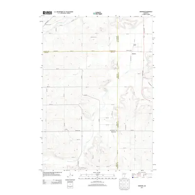
2013 Map of Dennison
USGS Topo · Published 2013About this map
Stanton and Dennison anchor this agricultural landscape at the intersection of Dakota, Rice, and Goodhue Counties. The terrain is defined by the winding course of the Cannon River in the northwest, while Prairie Cr and Spring Cr drain the central and eastern sections. Local commerce and land use are clearly represented through sites like the White Barn Orchard and the Stanton Airfield, which sits just west of Stanton. The map provides specific detail for genealogists and local historians, including the location of the Prairie Creek Cem south of Dennison Blvd S. A dense network of named roads, such as Sciota Trl and High Prairie Trl, reflects the established rural infrastructure of the early 21st century.
Find a feature on this map
57 named features on this map. Tap any name to fly to it.
Don’t see what you’re looking for? This feature index may not catch every label — zoom into the map to look around manually.
Map Details
Editions of this 2013 Dennison Map
This is the sole edition of this map. No revisions or reprints were ever made.
Other maps of this area

1953 · Saint Paul
USGS Topo · 1:250,000

1957 · Farmington
USGS Topo · 1:62,500

1957 · Hastings
USGS Topo · 1:62,500

1959 · Saint Paul
USGS Topo · 1:250,000

1960 · Northfield
USGS Topo · 1:24,000

1960 · Cannon City
USGS Topo · 1:24,000

1960 · Dennison
USGS Topo · 1:24,000

1960 · Nerstrand
USGS Topo · 1:24,000

1968 · Kenyon
USGS Topo · 1:24,000

1968 · Sogn
USGS Topo · 1:24,000