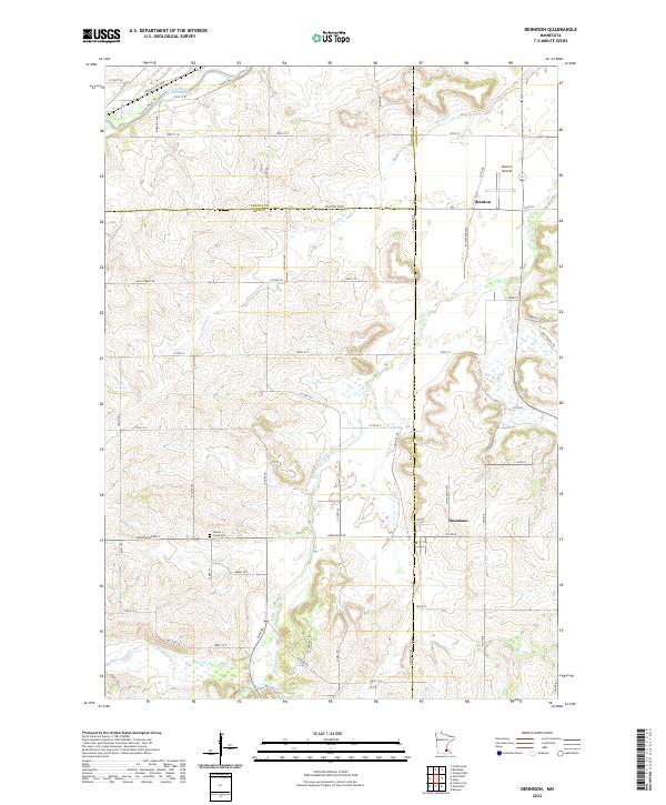
2022 Map of Dennison
USGS Topo · Published 2022About this map
Dennison sits at the junction of Rice and Goodhue counties, serving as a focal point for this rural agricultural landscape in southeastern Minnesota. The area is defined by the winding paths of the Cannon River in the northwest and the south-flowing Prairie Cr, which carves through the central terrain. To the north, the settlement of Stanton is positioned near the Stanton Airfield, reflecting the importance of localized transportation hubs in this region. The map preserves several historical routes, including Sciota Trl, Cannon River Trl, and High Prairie Trl, which follow the natural contours of the river valleys. Genealogists and local historians can locate the Prairie Creek Cem west of Dennison, a site established amidst the rolling fields between Spring Cr and the larger Prairie Creek drainage system.
Find a feature on this map
49 named features on this map. Tap any name to fly to it.
Don’t see what you’re looking for? This feature index may not catch every label — zoom into the map to look around manually.
Map Details
Editions of this 2022 Dennison Map
This is the sole edition of this map. No revisions or reprints were ever made.
Other maps of this area

1953 · Saint Paul
USGS Topo · 1:250,000

1957 · Farmington
USGS Topo · 1:62,500

1957 · Hastings
USGS Topo · 1:62,500

1959 · Saint Paul
USGS Topo · 1:250,000

1960 · Northfield
USGS Topo · 1:24,000

1960 · Cannon City
USGS Topo · 1:24,000

1960 · Dennison
USGS Topo · 1:24,000

1960 · Nerstrand
USGS Topo · 1:24,000

1968 · Kenyon
USGS Topo · 1:24,000

1968 · Sogn
USGS Topo · 1:24,000