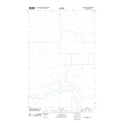
2011 Map of Dent Bridge NE
USGS Topo · Published 2011About this map
The Teton River carves a winding path through the southern reaches of this Chouteau County landscape, defining the local topography and historical travel routes. This 2011 survey captures a rural Montana environment where the river’s erratic course dictated the placement of long-standing infrastructure like Reichelt Ln and local thoroughfares. To the north, the land is partitioned by several named roads that reflect the area's agricultural and educational heritage, including Collins Rd and the suggestive Apple School Rd. The presence of Beaverslide Rd stretching across the central corridor serves as a reminder of the practical, often descriptive naming conventions used by early settlers to navigate the challenging northern plains. This map provides a detailed view of the interaction between the meandering river system and the grid of local roads that supported the region's ranching and farming operations in the early 21st century.
Find a feature on this map
5 named features on this map. Tap any name to fly to it.
Don’t see what you’re looking for? This feature index may not catch every label — zoom into the map to look around manually.
Map Details
Editions of this 2011 Dent Bridge NE Map
This is the sole edition of this map. No revisions or reprints were ever made.
Other maps of this area

1886 · Great Falls
USGS Topo · 1:250,000

1890 · Fort Benton
USGS Topo · 1:250,000

1892 · Fort Benton
USGS Topo · 1:250,000

1897 · Fort Benton
USGS Topo · 1:250,000

1950 · Dent Bridge
USGS Topo · 1:62,500

1953 · Carter
USGS Topo · 1:24,000

1954 · Great Falls
USGS Topo · 1:250,000

1954 · Shelby
USGS Topo · 1:250,000

1957 · Great Falls
USGS Topo · 1:250,000

1958 · Shelby
USGS Topo · 1:250,000