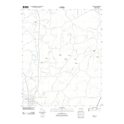
2010 Map of Denton
USGS Topo · Published 2010About this map
Denton anchors the southern portion of this landscape, where the local road network converges at the intersection of N Main St and Eastside Dr. Moving north, the terrain is defined by a series of prominent peaks including Steep Rock Mountain, Prickly Pear Mountain, Bell Mountain, and Sols Mountain. These heights overlook a complex drainage system led by Lick Creek and the South Fork Jackson Creek, which wind through rural tracts and small outlying settlements.
Find a feature on this map
68 named features on this map. Tap any name to fly to it.
Don’t see what you’re looking for? This feature index may not catch every label — zoom into the map to look around manually.
Map Details
Editions of this 2010 Denton Map
This is the sole edition of this map. No revisions or reprints were ever made.
Other maps of this area

1949 · High Rock
USGS Topo · 1:24,000

1949 · Denton NW
USGS Topo · 1:24,000

1950 · Lexington East
USGS Topo · 1:24,000

1951 · Lexington East
USGS Topo · 1:24,000

1951 · Fair Grove
USGS Topo · 1:24,000

1953 · Raleigh
USGS Topo · 1:250,000

1953 · Charlotte
USGS Topo · 1:250,000

1954 · Charlotte
USGS Topo · 1:250,000

1954 · Raleigh
USGS Topo · 1:250,000

1957 · Denton
USGS Topo · 1:62,500