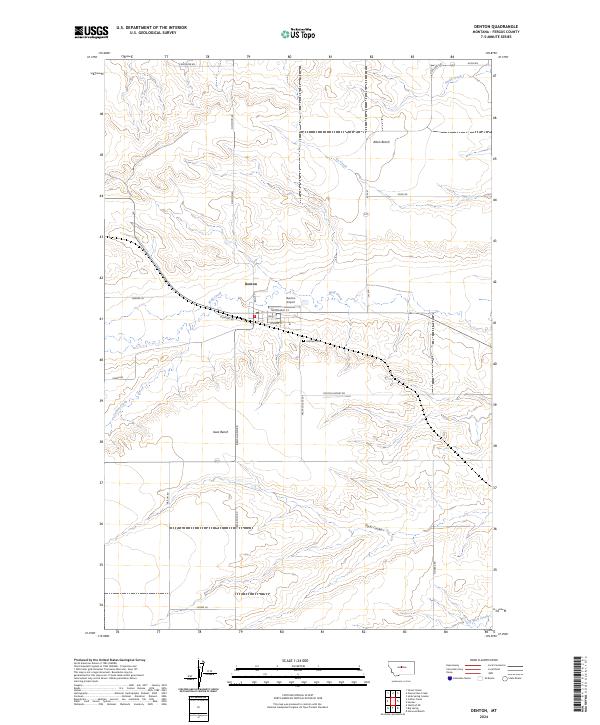
2024 Map of Denton
USGS Topo · Published 2024About this map
Denton serves as the central hub of this Fergus County agricultural landscape, situated at the confluence of Wolf Creek and its surrounding drainages. The town's layout is clearly defined by its street grid, including Main St and Broadway St, alongside essential community features like the Po and the nearby Denton Airport. This survey captures the town's position between the elevated Alton Bench to the north and Iowa Bench to the south, highlighting a topography shaped by winding coulees and intermittent watercourses. Family-named roads like Barber Ln and Knox Rd connect the scattered homesteads of this prairie region. To the southeast of the main settlement, the Hillcrest Cem stands on a rise, while the deeper geography of Pacer Coulee and Dry Wolf Creek reveals the natural drainage patterns of the Central Montana plains.
Find a feature on this map
36 named features on this map. Tap any name to fly to it.
Don’t see what you’re looking for? This feature index may not catch every label — zoom into the map to look around manually.
Map Details
Editions of this 2024 Denton Map
This is the sole edition of this map. No revisions or reprints were ever made.
Other maps of this area

1890 · Fort Benton
USGS Topo · 1:250,000

1892 · Fort Benton
USGS Topo · 1:250,000

1897 · Fort Benton
USGS Topo · 1:250,000

1954 · Great Falls
USGS Topo · 1:250,000

1954 · Lewistown
USGS Topo · 1:250,000

1957 · Great Falls
USGS Topo · 1:250,000

1959 · Lewistown
USGS Topo · 1:250,000

1970 · Harwood Bench
USGS Topo · 1:24,000
1970 · Big Spring
USGS Topo · 1:24,000
1978 · Stanford NE
USGS Topo · 1:24,000