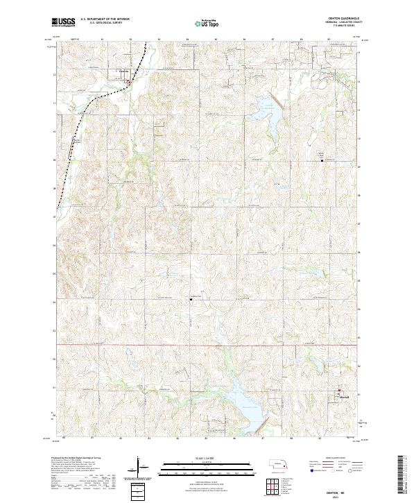
2021 Map of Denton
USGS Topo · Published 2021About this map
Denton sits at the northern edge of this Lancaster County landscape, where the prairie is defined by a complex network of reservoirs and creek branches. The terrain is deeply inscribed by the Salt Creek watershed, featuring numerous managed water bodies like Bluestem Lake, Yankee Hill Lake, and Killdeer Lake. These reservoirs, including Salt Cr Reservoir 23-B and Salt Cr Reservoir 17-A, illustrate a modern era of water management and recreation across the Nebraska plains.
Find a feature on this map
64 named features on this map. Tap any name to fly to it.
Don’t see what you’re looking for? This feature index may not catch every label — zoom into the map to look around manually.
Map Details
Editions of this 2021 Denton Map
This is the sole edition of this map. No revisions or reprints were ever made.
Other maps of this area

1897 · Lincoln
USGS Topo · 1:125,000

1955 · Lincoln
USGS Topo · 1:250,000

1957 · Lincoln
USGS Topo · 1:250,000

1958 · Lincoln
USGS Topo · 1:250,000

1964 · Cortland
USGS Topo · 1:24,000
1964 · Hallam
USGS Topo · 1:24,000
1964 · Crete South
USGS Topo · 1:24,000
1964 · Crete North
USGS Topo · 1:24,000

1964 · Denton
USGS Topo · 1:24,000

1964 · Roca
USGS Topo · 1:24,000