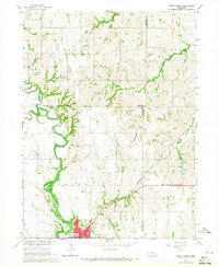
1964 Map of Crete North
USGS Topo · Published 1965About this map
The Big Blue River meanders through the heart of the eastern Nebraska plains, where the West Fork Big Blue River joins it just north of the growing community of Crete. This mid-century survey captures the region during a period of agricultural stability and local development, showing the concentrated street grid of the town alongside local landmarks like Tuxedo Park and Riverside Cem. Beyond the city limits, the landscape is defined by its educational and spiritual centers, such as St James Sch and Valley View Sch. The transportation network is anchored by the Chicago Burlington and Quincy railroad, which services the small siding of Berks. An Old Railroad Grade further north hints at earlier transit routes that once connected these rolling uplands. This sheet provides a clear view of the intersection between three counties—Seward, Saline, and Lancaster—marked by several creek systems including Cheese Creek and Walnut Creek.
Find a feature on this map
23 named features on this map. Tap any name to fly to it.
Don’t see what you’re looking for? This feature index may not catch every label — zoom into the map to look around manually.
Map Details
Editions of this 1964 Crete North Map
2 editions found
Other maps of this area

1897 · Lincoln
USGS Topo · 1:125,000

1934 · Seward
USGS Topo · 1:48,000

1935 · Dorchester
USGS Topo · 1:48,000

1939 · Seward
USGS Topo · 1:62,500

1940 · Dorchester
USGS Topo · 1:62,500

1955 · Lincoln
USGS Topo · 1:250,000

1957 · Lincoln
USGS Topo · 1:250,000

1958 · Lincoln
USGS Topo · 1:250,000
1964 · Pleasant Hill
USGS Topo · 1:24,000
1964 · Hallam
USGS Topo · 1:24,000