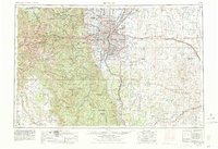
1957 Map of Denver
USGS Topo · Published 1957About this map
The Front Range of the Rockies meets the expanding Colorado capital in this mid-century portrait of a region defined by post-war growth and military infrastructure. Centered on Denver, the landscape is partitioned between the densely built urban core and a series of massive federal installations, including the Rocky Mountain Arsenal and Lowry AF Base. To the east, the plains of the Bijou Valley are marked by lonely railroad stops along the Union Pacific RR such as Deer Trail and Agate.
Find a feature on this map
238 named features on this map. Tap any name to fly to it.
Don’t see what you’re looking for? This feature index may not catch every label — zoom into the map to look around manually.
Map Details
Editions of this 1957 Denver Map
This is the sole edition of this map. No revisions or reprints were ever made.
Historical Maps of York Highlands Through Time
4 maps found