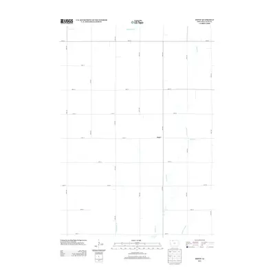
2013 Map of Depew
USGS Topo · Published 2013About this map
The small settlement of Depew serves as the focal point for this section of Palo Alto County, defined by its rectilinear grid of agricultural roads and an extensive network of water management features. The landscape is dominated by the winding course of Cylinder Cr, which is augmented by several numbered drainage systems including Ditch Number 21, Ditch Number 28, and Ditch Number 80. These engineered waterways, alongside Number Sixtyone, reflect the intensive land use and drainage efforts characteristic of the Iowa plains. The road system, comprised of numerical identifiers like 520th Ave and 320th St, organizes the territory into the traditional township-and-range pattern, showing the modern footprint of this rural farming community as recorded by the U.S. Geological Survey.
Find a feature on this map
22 named features on this map. Tap any name to fly to it.
Don’t see what you’re looking for? This feature index may not catch every label — zoom into the map to look around manually.
Map Details
Editions of this 2013 Depew Map
This is the sole edition of this map. No revisions or reprints were ever made.
Other maps of this area

1954 · Fairmont
USGS Topo · 1:250,000

1958 · Fairmont
USGS Topo · 1:250,000

1980 · Fenton
USGS Topo · 1:24,000

1980 · Depew
USGS Topo · 1:24,000

1980 · Seneca
USGS Topo · 1:24,000

1980 · Ringsted
USGS Topo · 1:24,000

1980 · Ingham Lake
USGS Topo · 1:24,000

1980 · Graettinger East
USGS Topo · 1:24,000
1980 · Emmetsburg
USGS Topo · 1:24,000
1980 · Whittemore
USGS Topo · 1:24,000