
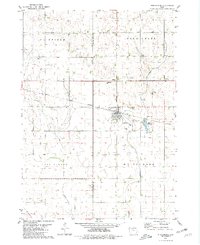
1980 Map of Fenton
USGS Topo · Published 1980About this map
The town of Fenton serves as the focal point of this North Central Iowa landscape, situated at the boundary of Fenton and Independence townships. During the late 1970s, the region was defined by its systematic agricultural grid and the persistence of small rural centers like Fairville. The map reveals a transitioning transportation network, where a former rail line is marked Abandoned, reflecting the shift away from the once-critical railroad economy that birthed these prairie settlements.
Find a feature on this map
20 named features on this map. Tap any name to fly to it.
Don’t see what you’re looking for? This feature index may not catch every label — zoom into the map to look around manually.
Map Details
Editions of this 1980 Fenton Map
This is the sole edition of this map. No revisions or reprints were ever made.
Other maps of this area

1954 · Fairmont
USGS Topo · 1:250,000

1958 · Fairmont
USGS Topo · 1:250,000

1980 · Lone Rock
USGS Topo · 1:24,000

1980 · Depew
USGS Topo · 1:24,000

1980 · Seneca
USGS Topo · 1:24,000

1980 · Ringsted
USGS Topo · 1:24,000

1980 · Armstrong SE
USGS Topo · 1:24,000

1980 · Hobarton
USGS Topo · 1:24,000
1980 · Whittemore
USGS Topo · 1:24,000
1980 · Cylinder
USGS Topo · 1:24,000