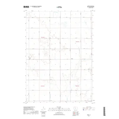
2018 Map of Depew
USGS Topo · Published 2018About this map
The tiny settlement of Depew sits at a rural crossroads in Palo Alto County, surrounded by the meticulously gridded township roads of northern Iowa. This landscape is defined by its agricultural transformation, where natural waterways like Cylinder Cr and Prairie Cr are supplemented by an extensive network of engineered drainage, including Ditch Number 21, Ditch Number 28, and Ditch Number 80. These channels were vital for converting the region's prairie wetlands into productive farmland. Genealogists and local historians will find significant value in the distribution of community landmarks across the townships, such as Vernon Township Cem to the west, Lutheran Cem in the east, and Saint Johns Cem along the southern border. The map also traces the path of Co Hwy B19, a primary east-west artery connecting these isolated farmsteads and rural cemeteries.
Find a feature on this map
23 named features on this map. Tap any name to fly to it.
Don’t see what you’re looking for? This feature index may not catch every label — zoom into the map to look around manually.
Map Details
Editions of this 2018 Depew Map
This is the sole edition of this map. No revisions or reprints were ever made.
Other maps of this area

1954 · Fairmont
USGS Topo · 1:250,000

1958 · Fairmont
USGS Topo · 1:250,000

1980 · Fenton
USGS Topo · 1:24,000

1980 · Depew
USGS Topo · 1:24,000

1980 · Seneca
USGS Topo · 1:24,000

1980 · Ringsted
USGS Topo · 1:24,000

1980 · Ingham Lake
USGS Topo · 1:24,000

1980 · Graettinger East
USGS Topo · 1:24,000
1980 · Emmetsburg
USGS Topo · 1:24,000
1980 · Whittemore
USGS Topo · 1:24,000