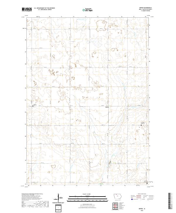
2022 Map of Depew
USGS Topo · Published 2022About this map
Depew serves as the central point of this modern survey of Palo Alto County, Iowa, where the landscape is defined by the intersection of a rigid section-line road grid and the natural meandering of northern Iowa's prairie waterways. The map illustrates an environment engineered for agriculture, where drainage systems like Ditch Number 21, Ditch Number 28, and Ditch Number 80 supplement the natural flow of Cylinder Cr. This management of the land allows for the expansive farming operations that surround the small settlement of Depew. For genealogists and local historians, several landmarks provide vital links to the area's heritage, specifically the Saint Johns Lutheran Cem, its companion Saint Johns Lutheran North Cem, and the Vernon Township Cem located on the western edge of the township.
Find a feature on this map
32 named features on this map. Tap any name to fly to it.
Don’t see what you’re looking for? This feature index may not catch every label — zoom into the map to look around manually.
Map Details
Editions of this 2022 Depew Map
This is the sole edition of this map. No revisions or reprints were ever made.
Other maps of this area

1954 · Fairmont
USGS Topo · 1:250,000

1958 · Fairmont
USGS Topo · 1:250,000

1980 · Fenton
USGS Topo · 1:24,000

1980 · Depew
USGS Topo · 1:24,000

1980 · Seneca
USGS Topo · 1:24,000

1980 · Ringsted
USGS Topo · 1:24,000

1980 · Ingham Lake
USGS Topo · 1:24,000

1980 · Graettinger East
USGS Topo · 1:24,000
1980 · Emmetsburg
USGS Topo · 1:24,000
1980 · Whittemore
USGS Topo · 1:24,000