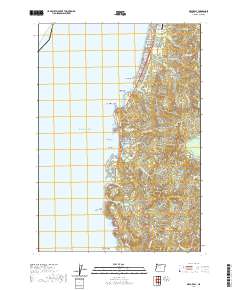
2020 Map of Depoe Bay
USGS Topo · Published 2020About this map
The coastal community of Depoe Bay centers this modern survey, highlighting its unique geography where the Pacific Ocean meets a network of small inlets and rocky outcrops. The landscape is defined by its maritime character, featuring landmarks such as Boiler Bay, Pirate Cove, and Whale Cove. Modern infrastructure is well-established, including the Siletz Bay State Airport in the north near Lincoln Beach and the historic Ben Jones Bridge further south near Otter Crest. The map reveals the relationship between the shoreline and the coastal hills, with drainage provided by numerous small waterways like Schoolhouse Cr and Deadhorse Cr. Higher elevations such as Siletz Hill overlook the narrow developed strip along the coast, which includes residential developments like Coronado Shores. The survey provides a clear view of the complex coastal topography, from Government Point to the prominent Cape Foulweather, which stands as a major navigational landmark.
Find a feature on this map
57 named features on this map. Tap any name to fly to it.
Don’t see what you’re looking for? This feature index may not catch every label — zoom into the map to look around manually.
Map Details
Editions of this 2020 Depoe Bay Map
This is the sole edition of this map. No revisions or reprints were ever made.
Other maps of this area

1941 · Cape Foulweather
USGS Topo · 1:62,500

1942 · Euchre Mtn
USGS Topo · 1:62,500

1942 · Yaquina
USGS Topo · 1:62,500

1942 · Toledo
USGS Topo · 1:62,500

1943 · Euchre Mtn
USGS Topo · 1:62,500

1944 · Cape Foulweather
USGS Topo · 1:62,500

1953 · Salem
USGS Topo · 1:250,000

1954 · Salem
USGS Topo · 1:250,000

1957 · Cape Foulweather
USGS Topo · 1:62,500

1957 · Yaquina
USGS Topo · 1:62,500