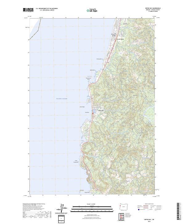
2024 Map of Depoe Bay
USGS Topo · Published 2024About this map
Depoe Bay and its narrow harbor define this stretch of the Oregon coast, where the landscape transitions from residential clusters like Lincoln Beach and Coronado Shores to the protected rocky headlands of the Oregon Islands National Wildlife Refuge. The terrain is marked by distinctive geological features including Cape Foulweather, Otter Crest, and the isolated spire of Gull Rock. Inland, the map documents the drainage patterns of coastal streams such as Fogarty Creek and Rocky Creek as they flow from the heights of Siletz Hill toward the Pacific Ocean. This modern survey details the contemporary layout of neighborhoods and critical infrastructure, including the Siletz Bay State Airport, while preserving the names of traditional landmarks like Boiler Bay and Pirate Cove that have long anchored the local maritime identity.
Find a feature on this map
54 named features on this map. Tap any name to fly to it.
Don’t see what you’re looking for? This feature index may not catch every label — zoom into the map to look around manually.
Map Details
Editions of this 2024 Depoe Bay Map
This is the sole edition of this map. No revisions or reprints were ever made.
Other maps of this area

1941 · Cape Foulweather
USGS Topo · 1:62,500

1942 · Euchre Mtn
USGS Topo · 1:62,500

1942 · Yaquina
USGS Topo · 1:62,500

1942 · Toledo
USGS Topo · 1:62,500

1943 · Euchre Mtn
USGS Topo · 1:62,500

1944 · Cape Foulweather
USGS Topo · 1:62,500

1953 · Salem
USGS Topo · 1:250,000

1954 · Salem
USGS Topo · 1:250,000

1957 · Cape Foulweather
USGS Topo · 1:62,500

1957 · Yaquina
USGS Topo · 1:62,500