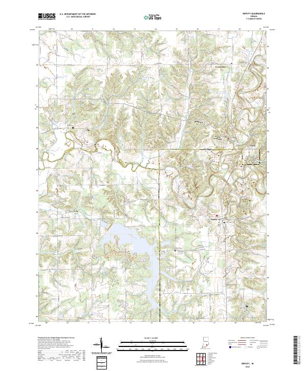
2022 Map of Deputy
USGS Topo · Published 2022About this map
Deputy serves as a central hub in this Southern Indiana landscape where the borders of Jennings, Scott, and Jefferson counties converge. The meandering path of the Muscatatuck River divides the terrain, creating a natural boundary that has influenced the layout of local roads and the distribution of settlements like Paris Crossing and Commiskey. The mapping of small rural hamlets such as Hilltown and Paris provides a detailed look at the enduring community structures in the region, centered around crossroads and small waterways.
Find a feature on this map
109 named features on this map. Tap any name to fly to it.
Don’t see what you’re looking for? This feature index may not catch every label — zoom into the map to look around manually.
Map Details
Editions of this 2022 Deputy Map
This is the sole edition of this map. No revisions or reprints were ever made.
Other maps of this area

1947 · Scottsburg
USGS Topo · 1:24,000

1956 · Volga
USGS Topo · 1:24,000

1956 · Blocher
USGS Topo · 1:24,000

1956 · Kent
USGS Topo · 1:24,000

1956 · Deputy
USGS Topo · 1:24,000

1956 · Louisville
USGS Topo · 1:250,000
1959 · Vernon
USGS Topo · 1:24,000
1959 · Hayden
USGS Topo · 1:24,000

1959 · Crothersville
USGS Topo · 1:24,000
1959 · Chestnut Ridge
USGS Topo · 1:24,000