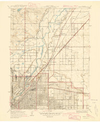
1940 Map of Derby
USGS Topo · Published 1940About this map
The industrial and agricultural fringes north of Denver are captured here in a 1938 survey, showcasing a landscape defined by water engineering and early aviation. The South Platte River and its major tributaries, Clear Creek and Sand Creek, provide the central axis for the region's development. This water is diverted into a complex network of irrigation works, including the Fulton Ditch, O'Brien Ditch, and the Highline Canal, which support the rural settlements of Welby and Irondale.
Find a feature on this map
40 named features on this map. Tap any name to fly to it.
Don’t see what you’re looking for? This feature index may not catch every label — zoom into the map to look around manually.
Map Details
Editions of this 1940 Derby Map
2 editions found
Other maps of this area

1890 · East Denver
USGS Topo · 1:125,000

1899 · West Denver
USGS Topo · 1:125,000

1935 · East Denver Nos. 3 and 4
USGS Topo · 1:48,000

1938 · Derby
USGS Topo · 1:24,000

1938 · Long Branch
USGS Topo · 1:24,000

1940 · Brighton
USGS Topo · 1:31,680

1940 · Englewood
USGS Topo · 1:31,680

1940 · Eastlake
USGS Topo · 1:31,680

1940 · Lafayette
USGS Topo · 1:31,680

1940 · Derby
USGS Topo · 1:31,680