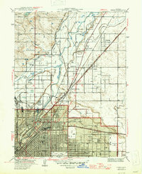
1947 Map of Derby
USGS Topo · Published 1947About this map
The industrial and agricultural outskirts of Denver appear in this 1938 survey, dominated by a complex network of irrigation ditches and railroads converging on the city. The South Platte River and Sand Creek anchor the landscape, which is partitioned by the Union Pacific and Chicago Burlington and Quincy lines. To the south, the city's expanding grid reaches the Denver City and Co Airport and the sprawling Stockyards, while older communities like Argo and Globeville represent the area's early working-class roots.
Find a feature on this map
73 named features on this map. Tap any name to fly to it.
Don’t see what you’re looking for? This feature index may not catch every label — zoom into the map to look around manually.
Map Details
Editions of this 1947 Derby Map
2 editions found
Other maps of this area

1890 · East Denver
USGS Topo · 1:125,000

1899 · West Denver
USGS Topo · 1:125,000

1935 · East Denver Nos. 3 and 4
USGS Topo · 1:48,000

1938 · Derby
USGS Topo · 1:24,000

1938 · Long Branch
USGS Topo · 1:24,000

1940 · Brighton
USGS Topo · 1:31,680

1940 · Englewood
USGS Topo · 1:31,680

1940 · Eastlake
USGS Topo · 1:31,680

1940 · Lafayette
USGS Topo · 1:31,680

1940 · Derby
USGS Topo · 1:31,680