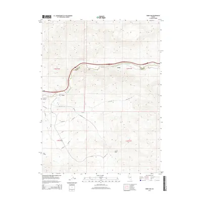
2014 Map of Derby Dam
USGS Topo · Published 2014About this map
The Truckee River carves a critical path through the high desert of the Washoe Co Storey Co border, serving as the primary geographic corridor for both natural and man-made infrastructure. This 2014 survey captures the area as the USA Pky corridor began to fundamentally reshape the landscape, connecting the traditional river-valley settlements of Clark and Thisby with new industrial and logistical developments south of the river. While the river remains the anchor, the map reveals a complex grid of modern road names like Milan Dr and Portofino Dr that speak to planned growth in the foothills. To the south, the deep drainage of Post Canyon highlights the transition into more isolated terrain, contrasting with the active transport network following the river and the path of Canal Rd.
Find a feature on this map
25 named features on this map. Tap any name to fly to it.
Don’t see what you’re looking for? This feature index may not catch every label — zoom into the map to look around manually.
Map Details
Editions of this 2014 Derby Dam Map
This is the sole edition of this map. No revisions or reprints were ever made.
Other maps of this area

1890 · Wadsworth
USGS Topo · 1:125,000

1891 · Carson
USGS Topo · 1:125,000

1891 · Wabuska
USGS Topo · 1:125,000

1891 · Reno
USGS Topo · 1:125,000

1892 · Wadsworth
USGS Topo · 1:125,000

1893 · Carson
USGS Topo · 1:125,000

1893 · Reno
USGS Topo · 1:125,000

1894 · Wadsworth
USGS Topo · 1:125,000

1894 · Wabuska
USGS Topo · 1:125,000

1950 · Virginia City
USGS Topo · 1:62,500