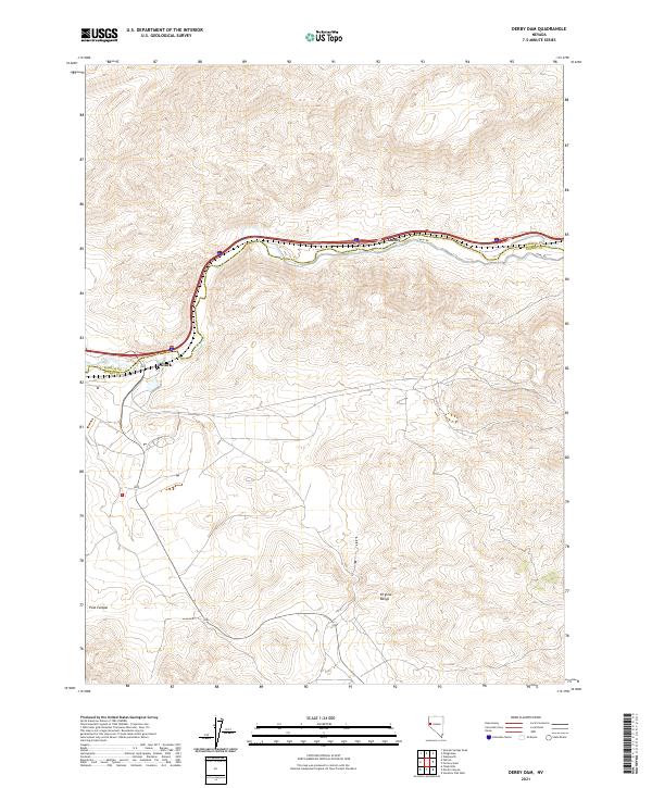
2021 Map of Derby Dam
USGS Topo · Published 2021About this map
The Virginia Range dominates the southern portion of this region along the boundary of Washoe and Storey counties, where the high desert terrain transitions into steep ridges and canyons. The northern portion of the landscape is bisected by a prominent transportation corridor that follows the valley floor, connecting the small settlements of Clark and Thisby. This corridor is defined by the proximity of modern infrastructure to historic routes like Canal Rd, which traces the contours of the local waterways and irrigation efforts essential to the area. Further south, the remote character of Post Canyon suggests the difficulty of the terrain, while the township and range lines—specifically t20n r22e and t19n r23e—provide a rigid grid over the undulating natural topography of the Great Basin.
Find a feature on this map
10 named features on this map. Tap any name to fly to it.
Don’t see what you’re looking for? This feature index may not catch every label — zoom into the map to look around manually.
Map Details
Editions of this 2021 Derby Dam Map
This is the sole edition of this map. No revisions or reprints were ever made.
Other maps of this area

1890 · Wadsworth
USGS Topo · 1:125,000

1891 · Carson
USGS Topo · 1:125,000

1891 · Wabuska
USGS Topo · 1:125,000

1891 · Reno
USGS Topo · 1:125,000

1892 · Wadsworth
USGS Topo · 1:125,000

1893 · Carson
USGS Topo · 1:125,000

1893 · Reno
USGS Topo · 1:125,000

1894 · Wadsworth
USGS Topo · 1:125,000

1894 · Wabuska
USGS Topo · 1:125,000

1950 · Virginia City
USGS Topo · 1:62,500