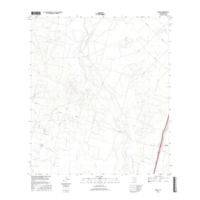
2016 Map of Derby
USGS Topo · Published 2016About this map
Frio River and Leona River converge in this brush-country landscape of Frio County, where a network of ephemeral creeks and watering tanks defines the South Texas ranching economy. The settlement of Derby sits at the southeastern corner of the sheet, positioned along the vital transportation corridor of the I-35 Access Rd. The land is heavily divided by rural roads like FM 1581 and Derby Rd, connecting scattered agricultural resources such as Chapote Tank and Cude Tank. This 2016 survey highlights the significance of drainage patterns in this semi-arid region, tracing the winding paths of Buck Cr, Live Oak Cr, and Todos Santos Cr as they navigate the subtle shifts in elevation toward Panther Hollow.
Find a feature on this map
28 named features on this map. Tap any name to fly to it.
Don’t see what you’re looking for? This feature index may not catch every label — zoom into the map to look around manually.
Map Details
Editions of this 2016 Derby Map
This is the sole edition of this map. No revisions or reprints were ever made.
Other maps of this area

1925 · Pearsall 1-b
USGS Topo · 1:48,000

1925 · Pearsall 1-c
USGS Topo · 1:48,000

1927 · Pearsall
USGS Topo · 1:62,500

1942 · Divot
USGS Topo · 1:62,500

1942 · Dilley
USGS Topo · 1:62,500

1953 · Crystal City
USGS Topo · 1:250,000

1955 · Crystal City
USGS Topo · 1:250,000

1956 · Woodward
USGS Topo · 1:62,500

1956 · Divot
USGS Topo · 1:62,500

1961 · Crystal City
USGS Topo · 1:250,000