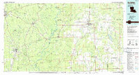
1986 Map of DeRidder
USGS Topo · Published 1986About this map
Kisatchie National Forest and the E C Oreoke State Forest dominate the piney woodlands of the Louisiana-Texas borderlands during the mid-1980s. This regional survey illustrates the deep connectivity between Beauregard and Vernon Parishes and their neighboring Texas counties, Jasper and Newton. The landscape is defined by the winding course of the Sabine River and an extensive network of waterways including Quicksand Creek, Bundick Creek, and Tenmile Creek.
Find a feature on this map
132 named features on this map. Tap any name to fly to it.
Don’t see what you’re looking for? This feature index may not catch every label — zoom into the map to look around manually.
Map Details
Editions of this 1986 DeRidder Map
2 editions found
Other maps of this area

1935 · Mittie
USGS Topo · 1:31,680

1935 · Gordon
USGS Topo · 1:31,680

1935 · Gaytine
USGS Topo · 1:31,680

1935 · Longville
USGS Topo · 1:31,680

1935 · Wilson Lake
USGS Topo · 1:31,680

1941 · Leesville
USGS Topo · 1:62,500

1941 · Slagle
USGS Topo · 1:62,500

1943 · Leesville
USGS Topo · 1:62,500

1943 · Leander
USGS Topo · 1:62,500

1944 · Wiergate
USGS Topo · 1:62,500