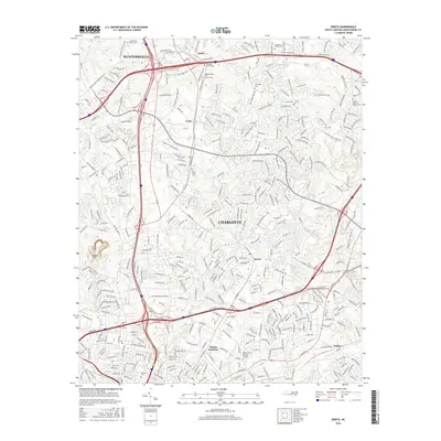
2016 Map of Derita
USGS Topo · Published 2016About this map
The Norfolk Southern rail line serves as a central spine through this North Carolina landscape, connecting industrial hubs like Atando Junction with the historic settlements of Croft, Derita, and the northern edge of Charlotte. The area is notably dense with community history, evidenced by a high concentration of sacred sites and burying grounds. Genealogists will find many significant landmarks including the Sugar Creek Burying Ground, Jonahville Cem, and the Independence Hill Church Cem. The terrain is shaped by the headwaters of several drainages, including Mallard Cr and Little Sugar Cr, while the presence of the Derita Mineral Spring points to the local hydrological history of the region. This 2016 survey documents a landscape where traditional small-town centers like Huntersville interface with modern infrastructure and suburban growth.
Find a feature on this map
386 named features on this map. Tap any name to fly to it.
Don’t see what you’re looking for? This feature index may not catch every label — zoom into the map to look around manually.
Map Details
Editions of this 2016 Derita Map
This is the sole edition of this map. No revisions or reprints were ever made.
Other maps of this area

1905 · Charlotte
USGS Topo · 1:48,000

1907 · Charlotte
USGS Topo · 1:62,500

1941 · Charlotte
USGS Topo · 1:125,000

1942 · Charlotte
USGS Topo · 1:125,000

1948 · Paw Creek
USGS Topo · 1:24,000

1948 · Derita
USGS Topo · 1:24,000

1948 · Charlotte East
USGS Topo · 1:24,000

1948 · Charlotte West
USGS Topo · 1:24,000

1949 · Kannapolis
USGS Topo · 1:24,000

1949 · Charlotte West
USGS Topo · 1:24,000