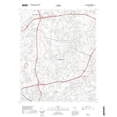
2019 Map of Derita
USGS Topo · Published 2019About this map
Derita Mineral Spring and the surrounding suburban expansion north of Charlotte define this landscape during the late 2010s. The map captures a transition from traditional rural landmarks to modern industrial and technology hubs. Older community anchors like Derita Sch and the Sugar Creek Burying Ground sit alongside the Harris Technology Blvd and the sprawling Metromont Industrial Blvd. This era reflects the heavy influence of the Norfolk Southern rail line on local development, with industrial nodes concentrated at Atando Junction and Croft.
Find a feature on this map
67 named features on this map. Tap any name to fly to it.
Don’t see what you’re looking for? This feature index may not catch every label — zoom into the map to look around manually.
Map Details
Editions of this 2019 Derita Map
This is the sole edition of this map. No revisions or reprints were ever made.
Other maps of this area

1905 · Charlotte
USGS Topo · 1:48,000

1907 · Charlotte
USGS Topo · 1:62,500

1941 · Charlotte
USGS Topo · 1:125,000

1942 · Charlotte
USGS Topo · 1:125,000

1948 · Paw Creek
USGS Topo · 1:24,000

1948 · Derita
USGS Topo · 1:24,000

1948 · Charlotte East
USGS Topo · 1:24,000

1948 · Charlotte West
USGS Topo · 1:24,000

1949 · Kannapolis
USGS Topo · 1:24,000

1949 · Charlotte West
USGS Topo · 1:24,000