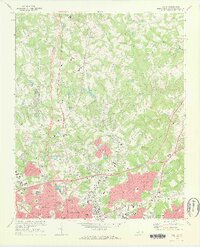
1972 Map of Derita
USGS Topo · Published 1973About this map
Derita and the northern outskirts of Charlotte are captured here during a period of significant suburban expansion in the early 1970s. The landscape is a mix of established rural communities like Croft and Joplor alongside emerging infrastructure. Cultural and recreational landmarks are prominent, including the Metrolina Fairgrounds and Brockenbrough Airport. The map provides excellent detail for genealogists, showing numerous local congregations such as Bethesda Ch and Williams Memorial Ch, as well as the Oaklawn Cem.
Find a feature on this map
89 named features on this map. Tap any name to fly to it.
Don’t see what you’re looking for? This feature index may not catch every label — zoom into the map to look around manually.
Map Details
Editions of this 1972 Derita Map
This is the sole edition of this map. No revisions or reprints were ever made.
Other maps of this area

1905 · Charlotte
USGS Topo · 1:48,000

1907 · Charlotte
USGS Topo · 1:62,500

1941 · Charlotte
USGS Topo · 1:125,000

1942 · Charlotte
USGS Topo · 1:125,000

1948 · Paw Creek
USGS Topo · 1:24,000

1948 · Derita
USGS Topo · 1:24,000

1948 · Charlotte East
USGS Topo · 1:24,000

1948 · Charlotte West
USGS Topo · 1:24,000

1949 · Kannapolis
USGS Topo · 1:24,000

1949 · Charlotte West
USGS Topo · 1:24,000