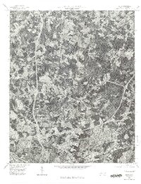
1976 Map of Derita
USGS Topo · Published 1978About this map
The northern expansion of Charlotte is captured in this mid-1970s orthophotoquad, showing the city's transition from an urban center into its northern Mecklenburg County hinterlands. The photographic imagery reveals a landscape undergoing rapid suburban development, where new residential street patterns and industrial corridors begin to overwrite the older agricultural blocks. The settlement of Derita sits at the heart of this change, positioned between the intensifying urban grid and the more open terrain to the north. Further afield, the smaller clusters of Croft and Joplor represent the rural character that preceded the city's northward march. This specific orthophoto format provides a rare, direct visual record of land use, including the distinct signatures of early interstate highway interchanges and commercial clearing that traditional topographic maps often abstract.
Find a feature on this map
4 named features on this map. Tap any name to fly to it.
Don’t see what you’re looking for? This feature index may not catch every label — zoom into the map to look around manually.
Map Details
Editions of this 1976 Derita Map
This is the sole edition of this map. No revisions or reprints were ever made.
Other maps of this area

1905 · Charlotte
USGS Topo · 1:48,000

1907 · Charlotte
USGS Topo · 1:62,500

1941 · Charlotte
USGS Topo · 1:125,000

1942 · Charlotte
USGS Topo · 1:125,000

1948 · Paw Creek
USGS Topo · 1:24,000

1948 · Derita
USGS Topo · 1:24,000

1948 · Charlotte East
USGS Topo · 1:24,000

1948 · Charlotte West
USGS Topo · 1:24,000

1949 · Kannapolis
USGS Topo · 1:24,000

1949 · Charlotte West
USGS Topo · 1:24,000