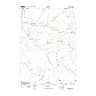
2010 Map of Derrick City
USGS Topo · Published 2010About this map
Derrick City and the surrounding drainages of McKean County define this 2010 survey of the northern Pennsylvania borderlands. The landscape is characterized by a series of deep hollows and runs, including Buchanan Hollow, Tibbitts Hollow, and Garlock Hollow, which dictate the winding paths of roads like Red Rock Rd and Dallas Rd. Small residential clusters such as Beechwood Heights, Fairview, and Sawyer City are scattered across the hillsides, connected by a network of creeks like Kendall Creek and Knapp Creek. South of the higher elevations, the terrain levels into the settlements of Aiken, Allen, and Middletown. The map shows a clear pattern of development constrained by the steep topography of the Allegheny Plateau, with larger centers like Foster Brook concentrated near the broader valley of Tunungwant Creek.
Find a feature on this map
58 named features on this map. Tap any name to fly to it.
Don’t see what you’re looking for? This feature index may not catch every label — zoom into the map to look around manually.
Map Details
Editions of this 2010 Derrick City Map
This is the sole edition of this map. No revisions or reprints were ever made.
Other maps of this area

1898 · Olean
USGS Topo · 1:62,500

1900 · Salamanca
USGS Topo · 1:62,500

1924 · Bradford
USGS Topo · 1:62,500

1926 · Bradford
USGS Topo · 1:62,500

1933 · Smethport
USGS Topo · 1:62,500

1937 · Smethport
USGS Topo · 1:62,500

1938 · Salamanca
USGS Topo · 1:62,500

1938 · Olean
USGS Topo · 1:62,500

1941 · Bradford
USGS Topo · 1:62,500

1943 · Olean
USGS Topo · 1:62,500