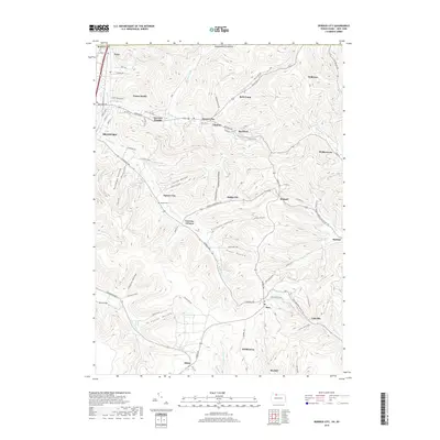
2019 Map of Derrick City
USGS Topo · Published 2019About this map
The northern reaches of Bradford and the surrounding Pennsylvania oil country appear here in meticulous detail. The landscape is defined by its deep drainages, including Garlock Hollow, Totten Hollow, and Buchanan Hollow, which slice through the plateau. Small industrial and residential clusters are scattered throughout the valleys, from Derrick City and Foster Brook in the west to the higher elevation settlements of Rew and Coleville in the southeast.
Find a feature on this map
86 named features on this map. Tap any name to fly to it.
Don’t see what you’re looking for? This feature index may not catch every label — zoom into the map to look around manually.
Map Details
Editions of this 2019 Derrick City Map
This is the sole edition of this map. No revisions or reprints were ever made.
Other maps of this area

1898 · Olean
USGS Topo · 1:62,500

1900 · Salamanca
USGS Topo · 1:62,500

1924 · Bradford
USGS Topo · 1:62,500

1926 · Bradford
USGS Topo · 1:62,500

1933 · Smethport
USGS Topo · 1:62,500

1937 · Smethport
USGS Topo · 1:62,500

1938 · Salamanca
USGS Topo · 1:62,500

1938 · Olean
USGS Topo · 1:62,500

1941 · Bradford
USGS Topo · 1:62,500

1943 · Olean
USGS Topo · 1:62,500