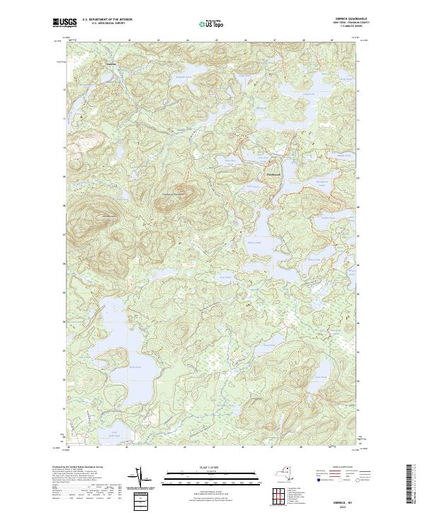
2023 Map of Derrick
USGS Topo · Published 2023About this map
Adirondack Park Preserve defines the character of this Franklin County landscape, where water and wilderness dominate the topography. The small settlements of Derrick and Floodwood serve as gateway points to an intricate network of glacial ponds and portage routes. A complex system of canoe carries and hiking paths, such as the Long To Bessie Carry Trl and the Floodwood Scout Trl, connects larger bodies like Rollins Pond and Floodwood Pond with smaller hidden waters like Pink Pond and Ledge Pond.
Find a feature on this map
61 named features on this map. Tap any name to fly to it.
Don’t see what you’re looking for? This feature index may not catch every label — zoom into the map to look around manually.
Map Details
Editions of this 2023 Derrick Map
This is the sole edition of this map. No revisions or reprints were ever made.
Other maps of this area

1904 · Long Lake
USGS Topo · 1:62,500

1905 · Saint Regis
USGS Topo · 1:62,500

1907 · Tupper Lake
USGS Topo · 1:62,500

1920 · Childwold
USGS Topo · 1:62,500

1921 · Childwold
USGS Topo · 1:48,000

1922 · Childwold
USGS Topo · 1:62,500

1948 · Ogdensburg
USGS Topo · 1:250,000

1951 · Ogdensburg
USGS Topo · 1:250,000

1953 · Ogdensburg
USGS Topo · 1:250,000

1954 · Tupper Lake
USGS Topo · 1:62,500