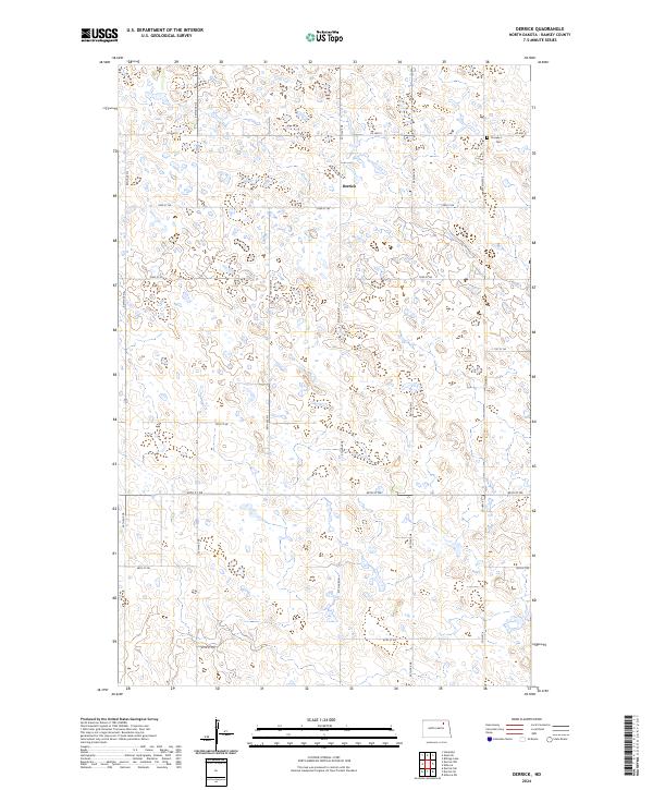
2024 Map of Derrick
USGS Topo · Published 2024About this map
Derrick sits at the heart of this prairie landscape, serving as a focal point for a region defined by its complex glacial topography and agricultural grid. The terrain is characterized by a dense network of small wetlands and potholes, many of which are protected within the Ramsey County Waterfowl Production Area. This conservation land is split into several distinct tracts, highlighting the importance of the local ecosystem for migratory birds. To the northeast, Prospect Cem offers a grounded connection to the area's early settlers, situated just off Co Hwy 9. The map reveals a highly structured section-line road system, with routes like 73rd St NE and 67th St NE providing access to the fertile lands between the myriad water bodies.
Find a feature on this map
15 named features on this map. Tap any name to fly to it.
Don’t see what you’re looking for? This feature index may not catch every label — zoom into the map to look around manually.
Map Details
Editions of this 2024 Derrick Map
This is the sole edition of this map. No revisions or reprints were ever made.
Other maps of this area

1953 · Devils Lake
USGS Topo · 1:250,000

1956 · Devils Lake
USGS Topo · 1:250,000

1970 · Alsen SE
USGS Topo · 1:24,000

1970 · Hampden
USGS Topo · 1:24,000

1972 · Derrick NW
USGS Topo · 1:24,000

1972 · Derrick
USGS Topo · 1:24,000

1972 · Derrick SE
USGS Topo · 1:24,000
1972 · Derrick SW
USGS Topo · 1:24,000

1972 · Edmore SW
USGS Topo · 1:24,000

1972 · Edmore
USGS Topo · 1:24,000